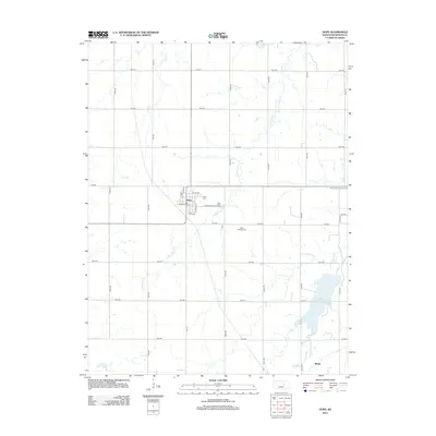
2012 Map of Hope
USGS Topo · Published 2012About this map
The agricultural heart of Dickinson County centers on Hope, a town structured by a grid of streets including Hope Ave and E Broadway St. This 2012 survey illustrates a landscape of established section lines and rural crossroads, where life is organized around the drainage basins of Carry Creek and the West Branch Lyon Creek. The community’s history is anchored by three distinct burial grounds: Hope Cemetery at the town's edge, Saint Phillips Cemetery to the south, and Saint Johns Lutheran Cemetery to the east, each serving as a vital touchstone for local genealogy. In the southeastern portion of the quadrangle, the Herington Reservoir provides a significant water feature near the small settlement of Rishel, reflecting the region’s management of prairie waterways like Lyon Creek.
Find a feature on this map
33 named features on this map. Tap any name to fly to it.
Don’t see what you’re looking for? This feature index may not catch every label — zoom into the map to look around manually.
Map Details
Editions of this 2012 Hope Map
This is the sole edition of this map. No revisions or reprints were ever made.
Other maps of this area

1889 · Abilene
USGS Topo · 1:125,000

1889 · Parkerville
USGS Topo · 1:125,000

1894 · Abilene
USGS Topo · 1:125,000

1894 · Parkerville
USGS Topo · 1:125,000

1955 · Hutchinson
USGS Topo · 1:250,000

1959 · Hutchinson
USGS Topo · 1:250,000

1963 · Abilene SW
USGS Topo · 1:24,000

1964 · Elmo
USGS Topo · 1:24,000

1964 · Ramona
USGS Topo · 1:24,000

1964 · Navarre
USGS Topo · 1:24,000