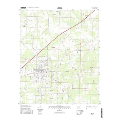
2017 Map of Hope
USGS Topo · Published 2017About this map
The President William Jefferson Clinton Birthplace Home National Historic Site serves as a central landmark in Hope, Arkansas, anchoring a landscape where small-town residential blocks give way to a network of creeks and rural outposts. To the south, the University of Arkansas Community College - Hope marks the edge of the city’s expansion, while the surrounding countryside is dotted with long-standing local landmarks like Rose Hill Cem and Robinson Cem. Outside the main settlement, the terrain is defined by the winding paths of Terre Rouge Cr and Pate Cr, which cut through the Hempstead County farmland towards smaller communities like Oakhaven and Perrytown. The map also captures several distinct topographical features such as Rocky Mound Hill, illustrating the transition from the structured urban grid of the county seat to the rolling elevations and wetlands of the Red River valley periphery.
Find a feature on this map
152 named features on this map. Tap any name to fly to it.
Don’t see what you’re looking for? This feature index may not catch every label — zoom into the map to look around manually.
Map Details
Editions of this 2017 Hope Map
This is the sole edition of this map. No revisions or reprints were ever made.
Other maps of this area

1901 · Gurdon
USGS Topo · 1:125,000

1951 · Blevins
USGS Topo · 1:24,000

1951 · Patmos
USGS Topo · 1:24,000

1951 · Sheppard
USGS Topo · 1:24,000

1951 · Spring Hill
USGS Topo · 1:24,000

1951 · Washington
USGS Topo · 1:24,000

1951 · Hope
USGS Topo · 1:24,000

1953 · El Dorado
USGS Topo · 1:250,000

1957 · El Dorado
USGS Topo · 1:250,000

1958 · El Dorado
USGS Topo · 1:250,000