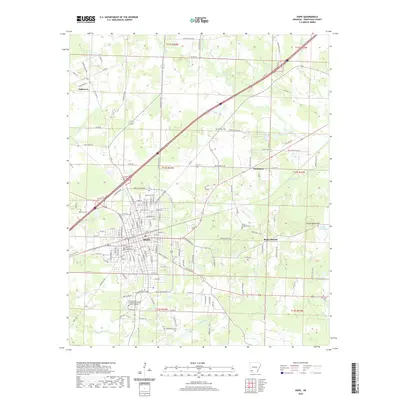
2020 Map of Hope
USGS Topo · Published 2020About this map
The Hempstead County Courthouse serves as the focal point for Hope, Arkansas, anchoring a grid of streets that transition into the wooded creek bottoms of southwestern Arkansas. This modern survey reflects the city's significant role as a regional educational and administrative center, featuring the University of Arkansas Community College At Hope and a network of arterial roads like State Hwy 32. Outside the city limits, the landscape is defined by small settlements such as Oakhaven, Perrytown, and Rocky-Mound, interspersed with family and community burial grounds including Rose Hill Cem and Phillips Cem. The terrain is characterized by the gentle drainage of Terre Rouge Cr and Bodcau Cr, while Rocky Mound Hill provides one of the few distinct elevations in the surrounding area.
Find a feature on this map
155 named features on this map. Tap any name to fly to it.
Don’t see what you’re looking for? This feature index may not catch every label — zoom into the map to look around manually.
Map Details
Editions of this 2020 Hope Map
This is the sole edition of this map. No revisions or reprints were ever made.
Other maps of this area

1901 · Gurdon
USGS Topo · 1:125,000

1951 · Blevins
USGS Topo · 1:24,000

1951 · Patmos
USGS Topo · 1:24,000

1951 · Sheppard
USGS Topo · 1:24,000

1951 · Spring Hill
USGS Topo · 1:24,000

1951 · Washington
USGS Topo · 1:24,000

1951 · Hope
USGS Topo · 1:24,000

1953 · El Dorado
USGS Topo · 1:250,000

1957 · El Dorado
USGS Topo · 1:250,000

1958 · El Dorado
USGS Topo · 1:250,000