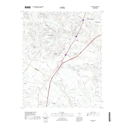
2019 Map of Hope Mills
USGS Topo · Published 2019About this map
Hope Mills and the southern edge of Fayetteville are the primary focus of this late 2010s survey, illustrating the modern suburban expansion across the Cumberland Co and Robeson Co line. The landscape is defined by the drainage of Rockfish Creek and its many tributaries like Little Rockfish Cr, which feed into various lakes and ponds such as Lake Charles and Rainey Pond. South of the urban center, the terrain shifts toward more open wetlands and basins characteristic of the coastal plain, including Gallberry Bay, Odom Bay, and the dense Buckhorn Swamp.
Find a feature on this map
287 named features on this map. Tap any name to fly to it.
Don’t see what you’re looking for? This feature index may not catch every label — zoom into the map to look around manually.
Map Details
Editions of this 2019 Hope Mills Map
This is the sole edition of this map. No revisions or reprints were ever made.
Other maps of this area

1948 · Fayetteville
USGS Topo · 1:62,500

1948 · Clifdale
USGS Topo · 1:62,500

1948 · Clifdale
USGS Topo · 1:24,000

1949 · Vander
USGS Topo · 1:24,000

1950 · Clifdale
USGS Topo · 1:24,000

1950 · Fayetteville
USGS Topo · 1:24,000

1951 · Clifdale
USGS Topo · 1:62,500

1953 · Florence
USGS Topo · 1:250,000

1953 · Raleigh
USGS Topo · 1:250,000

1954 · Florence
USGS Topo · 1:250,000