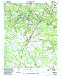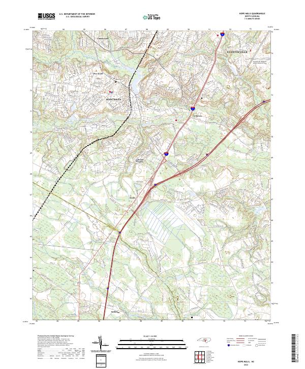
2022 Map of Hope Mills
USGS Topo · Published 2022About this map
Hope Mills serves as the focal point of this modern topographic record, situated south of Fayetteville where the suburban landscape meets the unique Carolina bay depressions of the coastal plain. The map documents a complex drainage system featuring Rockfish Creek and its various tributaries like Little Rockfish Cr and Horsepen Br, which define the local topography. Further south, the terrain shifts into the distinct elliptical depressions of Gallberry Bay and Odom Bay, landforms characteristic of this region's geography.
Find a feature on this map
37 named features on this map. Tap any name to fly to it.
Don’t see what you’re looking for? This feature index may not catch every label — zoom into the map to look around manually.
Map Details
Editions of this 2022 Hope Mills Map
This is the sole edition of this map. No revisions or reprints were ever made.