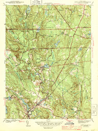
1943 Map of Hope Valley
USGS Topo · Published 1943About this map
The Wood River flows through a landscape of mill ponds and small rural villages during the early 1940s, connecting the industrial and agricultural life of southern Rhode Island. In Hope Valley and Wyoming, the density of structures along the banks of Locustville Pond and Canob Pond reflects the enduring reliance on water power for local industry. The survey details a highly fragmented landscape of small hills and swamps, where the historic New London Turnpike and Victory Highway intersect older colonial routes like Ten Rod Road. Genealogists will find significant local landmarks such as the Barber Cem, the Old Bates Sch, and the Wood River Ch. The northern portion of the map highlights the Beach Pond Recreation Area and the Fish Hatchery near Arcadia, marking a transition toward conservation and state-managed lands.
Find a feature on this map
62 named features on this map. Tap any name to fly to it.
Don’t see what you’re looking for? This feature index may not catch every label — zoom into the map to look around manually.
Map Details
Editions of this 1943 Hope Valley Map
2 editions found
Other maps of this area

1889 · Stonington
USGS Topo · 1:62,500

1889 · Charlestown
USGS Topo · 1:62,500

1889 · Moosup
USGS Topo · 1:62,500

1890 · Kent
USGS Topo · 1:62,500

1893 · Moosup
USGS Topo · 1:62,500

1893 · Stonington
USGS Topo · 1:62,500

1894 · Kent
USGS Topo · 1:62,500

1919 · Charlestown
USGS Topo · 1:62,500

1920 · Moosup
USGS Topo · 1:62,500

1921 · Charlestown
USGS Topo · 1:62,500