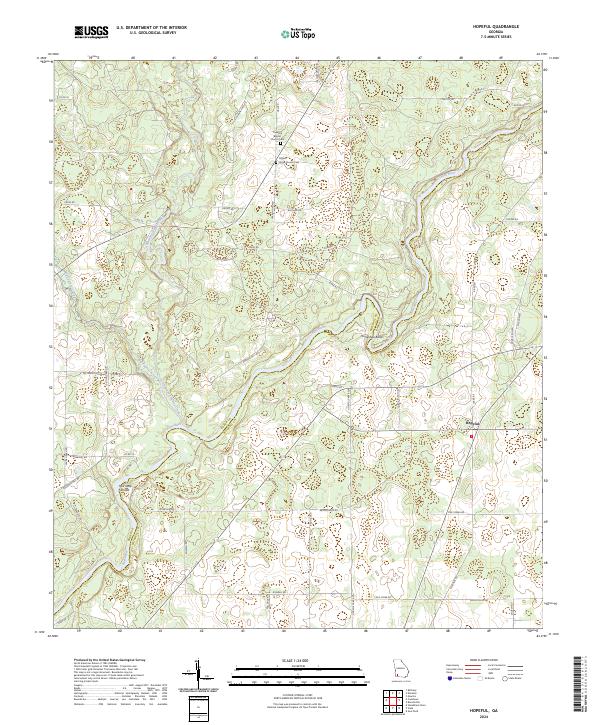
2024 Map of Hopeful
USGS Topo · Published 2024About this map
The Flint River meanders along the boundary between Baker and Mitchell counties, defining a landscape of low-lying wetlands and agricultural roads. The settlement of Hopeful serves as a local hub near the eastern edge of the quadrangle, connected by a network of rural routes including Fire Tower Rd and Colonial Rd. The river’s path is marked by distinctive navigational features such as the sharp curve of Horseshoe Bend and the aptly named Hell Gate Shoals further downstream.
Find a feature on this map
51 named features on this map. Tap any name to fly to it.
Don’t see what you’re looking for? This feature index may not catch every label — zoom into the map to look around manually.
Map Details
Editions of this 2024 Hopeful Map
This is the sole edition of this map. No revisions or reprints were ever made.
Other maps of this area

1953 · Dothan
USGS Topo · 1:250,000

1954 · Dothan
USGS Topo · 1:250,000

1955 · Dothan
USGS Topo · 1:250,000

1956 · Newton
USGS Topo · 1:62,500

1971 · Gee Pond
USGS Topo · 1:24,000

1971 · Vada
USGS Topo · 1:24,000

1971 · Hopeful
USGS Topo · 1:24,000
1971 · Branchville
USGS Topo · 1:24,000

1974 · Cooktown
USGS Topo · 1:24,000

1974 · Elmodel
USGS Topo · 1:24,000