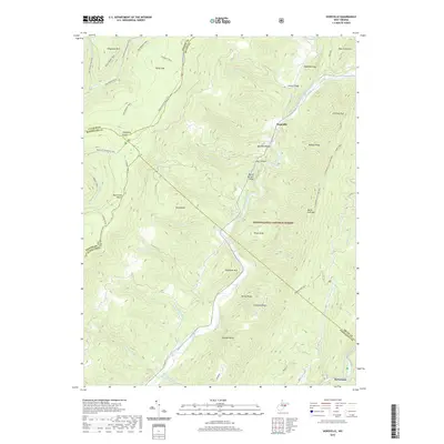
2019 Map of Hopeville
USGS Topo · Published 2019About this map
The North Fork South Branch Potomac River carves a deep path through this section of the Monongahela National Forest, defining the rugged topography of the Allegheny Front. The small settlement of Hopeville sits at the junction of several mountain ridges, including Shroud Ridge and Red Bud Ridge, while the hamlet of Ketterman lies further south along the riverbank. This area is characterized by dramatic elevation changes and geological landmarks like Champe Rocks and the distinctive Chimney Top peak.
Find a feature on this map
57 named features on this map. Tap any name to fly to it.
Don’t see what you’re looking for? This feature index may not catch every label — zoom into the map to look around manually.
Map Details
Editions of this 2019 Hopeville Map
This is the sole edition of this map. No revisions or reprints were ever made.
Other maps of this area

1892 · Franklin
USGS Topo · 1:125,000

1895 · Piedmont
USGS Topo · 1:125,000

1896 · Franklin
USGS Topo · 1:125,000

1916 · Davis
USGS Topo · 1:48,000

1918 · Davis
USGS Topo · 1:62,500

1919 · Davis
USGS Topo · 1:62,500

1920 · Davis
USGS Topo · 1:48,000

1920 · Petersburg
USGS Topo · 1:48,000

1920 · Onego
USGS Topo · 1:62,500

1921 · Petersburg
USGS Topo · 1:48,000