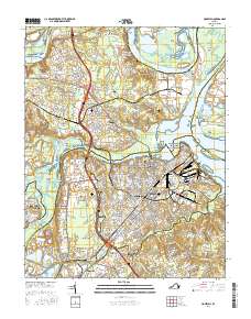
2016 Map of Hopewell
USGS Topo · Published 2016About this map
The Appomattox River and James River converge at City Point, a focal point of this industrial and residential landscape. The city of Hopewell occupies the heart of the region, flanked by established neighborhoods like Highland Park and Arlington. To the south, the sprawling grounds of Fort Lee and residential areas such as Jefferson Park reflect the area's growth and military importance. Transportation networks dominate the interior, with the CSX Transportation and Norfolk Southern railroads tracing paths alongside the modern I-295 corridor.
Find a feature on this map
114 named features on this map. Tap any name to fly to it.
Don’t see what you’re looking for? This feature index may not catch every label — zoom into the map to look around manually.
Map Details
Editions of this 2016 Hopewell Map
This is the sole edition of this map. No revisions or reprints were ever made.
Other maps of this area

1894 · Bermuda Hundred
USGS Topo · 1:62,500

1894 · Petersburg
USGS Topo · 1:62,500

1918 · Charles City
USGS Topo · 1:62,500

1919 · Disputanta
USGS Topo · 1:62,500

1938 · Dutch Gap
USGS Topo · 1:24,000

1938 · Drewrys Bluff
USGS Topo · 1:24,000

1943 · Dutch Gap
USGS Topo · 1:31,680

1943 · Hopewell
USGS Topo · 1:31,680

1943 · Disputanta
USGS Topo · 1:31,680

1943 · Richmond
USGS Topo · 1:250,000