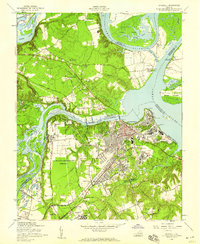
1952 Map of Hopewell
USGS Topo · Published 1959About this map
The Hopewell industrial waterfront and the sprawling Fort Lee military installation anchor this mid-century survey of the confluence of the James River and Appomattox River. The landscape reflects a dense layering of Virginia history, where the ancient Bermuda Hundred and the historic estate at Shirley sit near modern logistics, such as the Oil Terminal and the Seaboard Air Line railroad. The map records the complex river geography of the era, including the Turkey Island Cutoff and several river islands like Farrar Island and Eppes Island.
Find a feature on this map
90 named features on this map. Tap any name to fly to it.
Don’t see what you’re looking for? This feature index may not catch every label — zoom into the map to look around manually.
Map Details
Editions of this 1952 Hopewell Map
This is the sole edition of this map. No revisions or reprints were ever made.
Other maps of this area

1894 · Bermuda Hundred
USGS Topo · 1:62,500

1894 · Petersburg
USGS Topo · 1:62,500

1918 · Charles City
USGS Topo · 1:62,500

1919 · Disputanta
USGS Topo · 1:62,500

1938 · Dutch Gap
USGS Topo · 1:24,000

1938 · Drewrys Bluff
USGS Topo · 1:24,000

1943 · Dutch Gap
USGS Topo · 1:31,680

1943 · Hopewell
USGS Topo · 1:31,680

1943 · Disputanta
USGS Topo · 1:31,680

1943 · Richmond
USGS Topo · 1:250,000