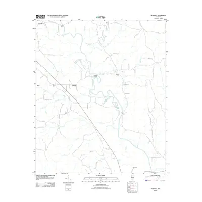
2012 Map of Hopewell
USGS Topo · Published 2012About this map
The Pearl River snakes through the center of this Mississippi landscape, defining the character of the borderlands between Copiah and Simpson counties. Settlement centers on the small communities of Gatesville and Hopewell, connected by a network of rural routes such as Old Highway 27 Road 2. The map reveals a dense concentration of local heritage sites, including several family and community burial grounds such as Zion Hill Cem, Palestine Cem, and Old Ruby Cem. Waterways like Brushy Creek and Reno Cr feed into the river basin, which is dotted with distinctive features like Allen Lake and Little Lake. The layout of local roads like Gatesville Rd and New Hope Rd reflects the enduring agricultural and residential patterns of this river valley region.
Find a feature on this map
74 named features on this map. Tap any name to fly to it.
Don’t see what you’re looking for? This feature index may not catch every label — zoom into the map to look around manually.
Map Details
Editions of this 2012 Hopewell Map
This is the sole edition of this map. No revisions or reprints were ever made.
Other maps of this area

1903 · Jackson
USGS Topo · 1:125,000

1906 · Florence
USGS Topo · 1:62,500

1908 · Florence
USGS Topo · 1:62,500

1937 · Terry
USGS Topo · 1:48,000

1943 · Terry
USGS Topo · 1:62,500

1953 · Natchez
USGS Topo · 1:250,000

1955 · Jackson
USGS Topo · 1:250,000

1956 · Natchez
USGS Topo · 1:250,000

1959 · Natchez
USGS Topo · 1:250,000

1961 · Jackson
USGS Topo · 1:250,000