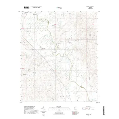
2018 Map of Hopewell
USGS Topo · Published 2018About this map
The Pearl River meanders along the border of Simpson and Copiah counties, defining the character of this rural Mississippi landscape. Small settlements like Gatesville and Hopewell serve as focal points for a network of country roads, while several historic crossings, including Gatesville Bridge, Hopewell Bridge, and Georgetown Bridge, connect the two counties across the river's winding path. The terrain is a complex web of drainage including Brushy Creek, Reno Creek, and Weeks Mill Creek, which flow through the forested bottoms and hills.
Find a feature on this map
71 named features on this map. Tap any name to fly to it.
Don’t see what you’re looking for? This feature index may not catch every label — zoom into the map to look around manually.
Map Details
Editions of this 2018 Hopewell Map
This is the sole edition of this map. No revisions or reprints were ever made.
Other maps of this area

1903 · Jackson
USGS Topo · 1:125,000

1906 · Florence
USGS Topo · 1:62,500

1908 · Florence
USGS Topo · 1:62,500

1937 · Terry
USGS Topo · 1:48,000

1943 · Terry
USGS Topo · 1:62,500

1953 · Natchez
USGS Topo · 1:250,000

1955 · Jackson
USGS Topo · 1:250,000

1956 · Natchez
USGS Topo · 1:250,000

1959 · Natchez
USGS Topo · 1:250,000

1961 · Jackson
USGS Topo · 1:250,000