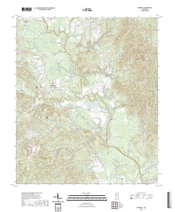
2024 Map of Hopewell
USGS Topo · Published 2024About this map
Pearl River meanders across the border of Simpson and Copiah counties, anchoring a landscape of wooded bottoms and creek-fed ridges. The small settlement of Hopewell sits centrally along Hopewell Rd, while Gatesville occupies the northwest corner of the survey. The region's social geography is clearly marked by numerous rural burial grounds, including the Palestine Cem and Zion Hill Cem, often located near crossroads and watercourses like Weeks Mill Creek. This 2024 map documents a rural Mississippi network of family-named roads such as Shine Garrett Rd and Jim Harris Rd, which connect remote homesteads to the river basin. The detailed mapping of Brushy Creek and Turkey Creek reveals the intricate drainage patterns that have historically shaped land use and property lines in this part of the state.
Find a feature on this map
73 named features on this map. Tap any name to fly to it.
Don’t see what you’re looking for? This feature index may not catch every label — zoom into the map to look around manually.
Map Details
Editions of this 2024 Hopewell Map
This is the sole edition of this map. No revisions or reprints were ever made.
Other maps of this area

1903 · Jackson
USGS Topo · 1:125,000

1906 · Florence
USGS Topo · 1:62,500

1908 · Florence
USGS Topo · 1:62,500

1937 · Terry
USGS Topo · 1:48,000

1943 · Terry
USGS Topo · 1:62,500

1953 · Natchez
USGS Topo · 1:250,000

1955 · Jackson
USGS Topo · 1:250,000

1956 · Natchez
USGS Topo · 1:250,000

1959 · Natchez
USGS Topo · 1:250,000

1961 · Jackson
USGS Topo · 1:250,000