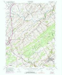
1954 Map of Hopewell
USGS Topo · Published 1990About this map
Ringoes and Hopewell anchor this mid-century portrait of the Jersey countryside, a landscape where early colonial routes like York Road and Old York Road still dictate the flow of travel through East Amwell. The map reveals a high density of named crossroads and hamlets, including Wertsville, Snydertown, and Linvale, which underscore the region's enduring rural settlement patterns. In the north, the Neshanic River and its branches wind through the terrain, while the Erie Lackawanna RR cuts across the western edge near Copper Hill.
Find a feature on this map
54 named features on this map. Tap any name to fly to it.
Don’t see what you’re looking for? This feature index may not catch every label — zoom into the map to look around manually.
Map Details
Editions of this 1954 Hopewell Map
4 editions found
Other maps of this area

1888 · Princeton
USGS Topo · 1:62,500

1890 · High Bridge
USGS Topo · 1:62,500

1890 · Lambertville
USGS Topo · 1:62,500

1891 · Somerville
USGS Topo · 1:62,500

1891 · Lambertville
USGS Topo · 1:62,500

1893 · Somerville
USGS Topo · 1:62,500

1894 · Princeton
USGS Topo · 1:62,500

1894 · Lambertville
USGS Topo · 1:62,500

1898 · High Bridge
USGS Topo · 1:62,500

1898 · Somerville
USGS Topo · 1:62,500
Featured Places
- Hillsborough Township, NJ
- Raritan Township, NJ
- Montgomery Township, NJ
- Hopewell Township, NJ
- Flemington, NJ