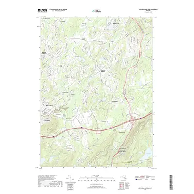
2019 Map of Hopewell Junction
USGS Topo · Published 2019About this map
Hopewell Junction and East Fishkill anchor this landscape where residential growth meets the enduring topography of the Hudson Highlands. The drainage patterns of Fishkill Creek, Sprout Creek, and the Whortlekill Cr dictate the settlement layout, which is punctuated by several significant burial grounds including the Van Wyck Cem and the Rombout Rural Cem. To the south, the terrain steepens significantly toward the Dutchess and Putnam county line, where the Sharp Reservation preserves large tracts of forested land near Gem Lake and Black Pond. This 2019 survey documents a modern road network that includes the George Brown Bridge, while still preserving the footprints of older hamlets like Wiccopee, Swartoutville, and Brinckerhoff that have long defined this part of Dutchess County.
Find a feature on this map
256 named features on this map. Tap any name to fly to it.
Don’t see what you’re looking for? This feature index may not catch every label — zoom into the map to look around manually.
Map Details
Editions of this 2019 Hopewell Junction Map
This is the sole edition of this map. No revisions or reprints were ever made.
Other maps of this area

1892 · West Point
USGS Topo · 1:62,500

1892 · Carmel
USGS Topo · 1:62,500

1893 · Carmel
USGS Topo · 1:62,500

1893 · Clove
USGS Topo · 1:62,500

1893 · Poughkeepsie
USGS Topo · 1:62,500

1894 · West Point
USGS Topo · 1:62,500

1894 · Clove
USGS Topo · 1:62,500

1894 · Carmel
USGS Topo · 1:62,500

1894 · Poughkeepsie
USGS Topo · 1:62,500

1898 · Clove
USGS Topo · 1:62,500