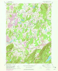
1981 Map of Hopewell Junction
USGS Topo · Published 1982About this map
Hopewell Junction sits at the heart of this Hudson Valley landscape, where the confluence of Whortlekill Creek and Fishkill Creek historically shaped the settlement patterns of Dutchess County. The map documents a period of transition as the area’s rural character met increasing post-war suburban development, seen in the expansion of residential clusters near Swartoutville and Lomala. While the Conrail line continues to track through the valley, the influence of the Taconic State Parkway is evident, carving through the terrain near Shenandoah Mountain.
Find a feature on this map
57 named features on this map. Tap any name to fly to it.
Don’t see what you’re looking for? This feature index may not catch every label — zoom into the map to look around manually.
Map Details
Editions of this 1981 Hopewell Junction Map
This is the sole edition of this map. No revisions or reprints were ever made.
Other maps of this area

1892 · West Point
USGS Topo · 1:62,500

1892 · Carmel
USGS Topo · 1:62,500

1893 · Carmel
USGS Topo · 1:62,500

1893 · Clove
USGS Topo · 1:62,500

1893 · Poughkeepsie
USGS Topo · 1:62,500

1894 · West Point
USGS Topo · 1:62,500

1894 · Clove
USGS Topo · 1:62,500

1894 · Carmel
USGS Topo · 1:62,500

1894 · Poughkeepsie
USGS Topo · 1:62,500

1898 · Clove
USGS Topo · 1:62,500