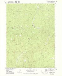
1979 Map of Hopkins Butte
USGS Topo · Published 1979About this map
Six Rivers National Forest and the Hoopa Valley Indian Reservation meet along a prominent boundary line that bisects this mountainous terrain in northern California. The map documents a landscape defined by significant elevation changes and high ridges, including Mill Creek Ridge and Packsaddle Ridge. Historically, this area supported small-scale extraction and early settlement, evidenced by the presence of the Ferris Mine, the Red Cap Central Mine, and the hydraulic or placer workings at Schnable Diggings.
Find a feature on this map
65 named features on this map. Tap any name to fly to it.
Don’t see what you’re looking for? This feature index may not catch every label — zoom into the map to look around manually.
Map Details
Editions of this 1979 Hopkins Butte Map
2 editions found
Other maps of this area

1925 · Hoopa
USGS Topo · 1:125,000

1948 · Weed
USGS Topo · 1:250,000

1950 · Weed
USGS Topo · 1:250,000

1952 · Hoopa
USGS Topo · 1:62,500

1952 · Orleans
USGS Topo · 1:62,500

1955 · Salmon Mtn
USGS Topo · 1:62,500

1955 · Forks of Salmon
USGS Topo · 1:62,500

1958 · Weed
USGS Topo · 1:250,000

1963 · Weed
USGS Topo · 1:250,000

1974 · Orleans Mtn.
USGS Topo · 1:24,000