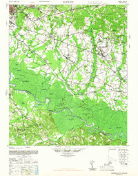
1948 Map of Hopkins
USGS Topo · Published 1965About this map
The Congaree River corridor defines the landscape of this 1948 survey, winding through a complex of oxbows and backwaters like Saylors Lake, Dead River, and Mullers Big Lake. In the northern uplands, the suburban expansion of Columbia is evident near the U S Veterans Hospital and Greenlawn Cem, while the central and eastern portions remain deeply rural. This area is characterized by a dense network of country schools and churches that served the agricultural communities of Hopkins, Gadsden, and Lykosland.
Find a feature on this map
117 named features on this map. Tap any name to fly to it.
Don’t see what you’re looking for? This feature index may not catch every label — zoom into the map to look around manually.
Map Details
Editions of this 1948 Hopkins Map
3 editions found

Other maps of this area

1904 · Columbia
USGS Topo · 1:125,000

1935 · Killian
USGS Topo · 1:48,000

1937 · Killian
USGS Topo · 1:62,500

1938 · Hagood
USGS Topo · 1:62,500

1941 · Spartanburg
USGS Topo · 1:250,000

1942 · Camden
USGS Topo · 1:125,000

1943 · Eastover
USGS Topo · 1:62,500

1944 · Edmund
USGS Topo · 1:62,500

1946 · Elloree
USGS Topo · 1:62,500

1946 · Woodford
USGS Topo · 1:62,500