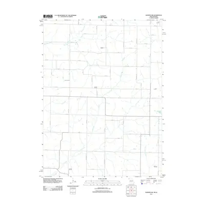
2011 Map of Hopkins SW
USGS Topo · Published 2011About this map
The agricultural landscape along the Missouri-Iowa border is defined by a systematic grid of section roads and the winding paths of several local waterways. This rural terrain is drained by Clear Creek and its tributary South Fork Clear Creek, alongside Buchanan Creek to the north and Wolf Creek to the west. The map provides significant genealogical value through its density of family and community burial grounds, including the Hazel Dell Cemetery, Siam Cemetery, and Morehouse Cemetery. This distribution of landmarks like the Shearer Cemetery, Burch Cemetery, and Johnson Cemetery suggests a history of decentralized farmstead settlements. Small water features such as Blackford Lake dot the countryside, which is otherwise heavily divided into township squares by routes like Co Hwy J55 and numerous lettered avenues.
Find a feature on this map
49 named features on this map. Tap any name to fly to it.
Don’t see what you’re looking for? This feature index may not catch every label — zoom into the map to look around manually.
Map Details
Editions of this 2011 Hopkins SW Map
This is the sole edition of this map. No revisions or reprints were ever made.
Other maps of this area

1939 · Skidmore
USGS Topo · 1:62,500

1940 · Coin
USGS Topo · 1:62,500

1940 · New Market
USGS Topo · 1:62,500

1941 · Skidmore
USGS Topo · 1:62,500

1942 · Skidmore
USGS Topo · 1:62,500

1943 · Coin
USGS Topo · 1:62,500

1943 · Maryville
USGS Topo · 1:62,500

1943 · New Market
USGS Topo · 1:62,500

1955 · Nebraska City
USGS Topo · 1:250,000

1957 · Nebraska City
USGS Topo · 1:250,000