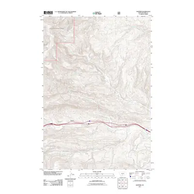
2011 Map of Hoppers
USGS Topo · Published 2011About this map
Cokedale and the surrounding mountain drainages define this landscape in Park County, where historical mining operations left a distinct mark on the terrain. The settlement of Cokedale is centered near Cokedale Mines Number 1 and Cokedale Mines Number 2, with the Cokedale Cemetery serving as a significant site for genealogical research. The transportation corridor follows the path of Billman Creek, where the rail line passes through Tunnel Number 1 near Hoppers. To the north, the geography is shaped by numerous watercourses including Fleshman Creek, Perkins Creek, and Area Creek. This area shows a transition from industrial mining history to modern recreational and residential use, evidenced by the network of local routes like Pony Rd, Antelope Flts, and the Eldridge Creek Trl winding through the foothills.
Find a feature on this map
30 named features on this map. Tap any name to fly to it.
Don’t see what you’re looking for? This feature index may not catch every label — zoom into the map to look around manually.
Map Details
Editions of this 2011 Hoppers Map
This is the sole edition of this map. No revisions or reprints were ever made.
Other maps of this area

1891 · Livingston
USGS Topo · 1:250,000

1893 · Livingston
USGS Topo · 1:250,000

1947 · Bozeman
USGS Topo · 1:250,000

1948 · Bozeman
USGS Topo · 1:250,000

1951 · Bozeman Pass
USGS Topo · 1:62,500

1951 · Gobblers Knob
USGS Topo · 1:24,000

1951 · Chadborn
USGS Topo · 1:24,000

1951 · Brisbin
USGS Topo · 1:24,000

1951 · Hoppers
USGS Topo · 1:24,000

1951 · Chimney Rock
USGS Topo · 1:24,000