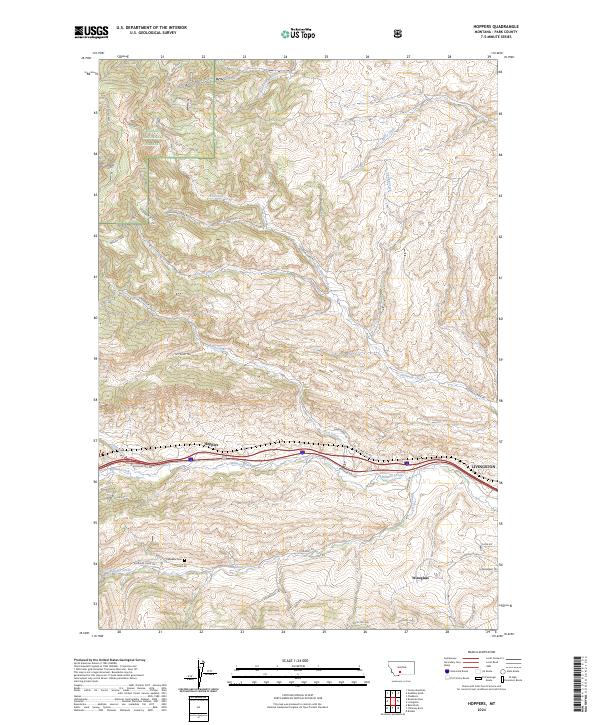
2024 Map of Hoppers
USGS Topo · Published 2024About this map
Hoppers and the western edge of Livingston anchor this Montana landscape, where the foothills of the Gallatin National Forest meet the drainage systems of Billman Creek and Fleshman Creek. The map documents a complex network of forest access and rural routes, including the Bozeman Hill Rd corridor and Cokedale Rd, which leads toward the Cokedale Cem. This area serves as a transition from the higher terrain of Molar and Rock Top Pass down to the level grounds of Antelope Flats.
Find a feature on this map
41 named features on this map. Tap any name to fly to it.
Don’t see what you’re looking for? This feature index may not catch every label — zoom into the map to look around manually.
Map Details
Editions of this 2024 Hoppers Map
This is the sole edition of this map. No revisions or reprints were ever made.
Other maps of this area

1891 · Livingston
USGS Topo · 1:250,000

1893 · Livingston
USGS Topo · 1:250,000

1947 · Bozeman
USGS Topo · 1:250,000

1948 · Bozeman
USGS Topo · 1:250,000

1951 · Bozeman Pass
USGS Topo · 1:62,500

1951 · Gobblers Knob
USGS Topo · 1:24,000

1951 · Chadborn
USGS Topo · 1:24,000

1951 · Brisbin
USGS Topo · 1:24,000

1951 · Hoppers
USGS Topo · 1:24,000

1951 · Chimney Rock
USGS Topo · 1:24,000