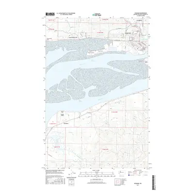
2017 Map of Hoquiam
USGS Topo · Published 2017About this map
Hoquiam and its complex estuarine landscape are defined by the convergence of the Hoquiam River, Chehalis River, and the various channels that snake through the mudflats. The city's residential grid stretches north toward Woodlawn, while industrial and maritime infrastructure clings to the waterfront. Significant landmarks include the Bowerman Airport situated on Moon Island and the Hoquiam River Bridge Simpson Avenue connecting the eastern and western halves of the community.
Find a feature on this map
79 named features on this map. Tap any name to fly to it.
Don’t see what you’re looking for? This feature index may not catch every label — zoom into the map to look around manually.
Map Details
Editions of this 2017 Hoquiam Map
This is the sole edition of this map. No revisions or reprints were ever made.
Other maps of this area

1938 · Moclips
USGS Topo · 1:62,500

1941 · Moclips
USGS Topo · 1:62,500

1941 · Grayland
USGS Topo · 1:62,500

1943 · Humptulips
USGS Topo · 1:62,500

1943 · Copalis Beach
USGS Topo · 1:250,000

1951 · Copalis Beach
USGS Topo · 1:250,000

1953 · Hoquiam
USGS Topo · 1:250,000

1955 · Humptulips
USGS Topo · 1:62,500

1955 · Aberdeen SE
USGS Topo · 1:24,000

1956 · Copalis Crossing
USGS Topo · 1:24,000