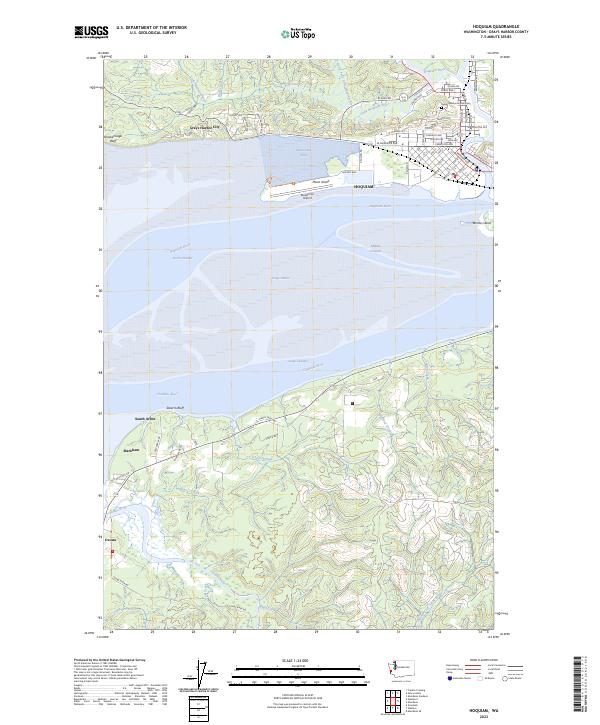
2023 Map of Hoquiam
USGS Topo · Published 2023About this map
The Hoquiam waterfront and the industrial shoreline of Grays Harbor dominate this coastal survey. The convergence of the Hoquiam River and the Chehalis River creates a complex network of estuarine channels, including the North Channel, Middle Channel, and South Channel. This aquatic geography is interrupted by features like Moon Island—home to Bowerman Airport—and the tidal flats of the Bowerman Basin. To the north, the town grid of Hoquiam transitions into the rising terrain of Brackenridge Bluff, while the city's cemetery, Sunset Memorial Park Cem, sits near the river bend.
Find a feature on this map
64 named features on this map. Tap any name to fly to it.
Don’t see what you’re looking for? This feature index may not catch every label — zoom into the map to look around manually.
Map Details
Editions of this 2023 Hoquiam Map
This is the sole edition of this map. No revisions or reprints were ever made.
Other maps of this area

1938 · Moclips
USGS Topo · 1:62,500

1941 · Moclips
USGS Topo · 1:62,500

1941 · Grayland
USGS Topo · 1:62,500

1943 · Humptulips
USGS Topo · 1:62,500

1943 · Copalis Beach
USGS Topo · 1:250,000

1951 · Copalis Beach
USGS Topo · 1:250,000

1953 · Hoquiam
USGS Topo · 1:250,000

1955 · Humptulips
USGS Topo · 1:62,500

1955 · Aberdeen SE
USGS Topo · 1:24,000

1956 · Copalis Crossing
USGS Topo · 1:24,000