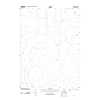
2011 Map of Horace
USGS Topo · Published 2011About this map
Horace is situated within the drainage basin of the North Loup River in Greeley County, Nebraska. This 2011 survey illustrates a quiet agricultural landscape defined by the convergence of several waterways, including the meandering Wallace Creek, Shephard Creek, and Fish Creek. The map provides specific locations for genealogical research, identifying the Shelton Cemetery and Pleasant Hill Cemetery as key landmarks among the section lines and farm roads. The rural infrastructure is anchored by routes like N Scotia Rd and Co Rd, which connect the settlement of Horace to the surrounding prairie. The topography is marked by the subtle drainages and intermittent streams that feed into the larger river system, reflecting the enduring rural character of central Nebraska in the early 21st century.
Find a feature on this map
9 named features on this map. Tap any name to fly to it.
Don’t see what you’re looking for? This feature index may not catch every label — zoom into the map to look around manually.
Map Details
Editions of this 2011 Horace Map
This is the sole edition of this map. No revisions or reprints were ever made.
Other maps of this area

1899 · Loup
USGS Topo · 1:125,000

1953 · North Loup
USGS Topo · 1:24,000

1953 · Scotia NE
USGS Topo · 1:24,000

1953 · Scotia
USGS Topo · 1:24,000

1954 · Ord SE
USGS Topo · 1:24,000

1954 · Ord NE
USGS Topo · 1:24,000

1954 · Horace
USGS Topo · 1:24,000

1954 · Greeley NE
USGS Topo · 1:24,000

1954 · Greeley
USGS Topo · 1:24,000

1954 · Greeley NW
USGS Topo · 1:24,000