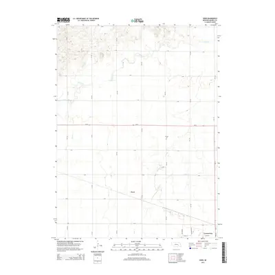
2014 Map of Hord
USGS Topo · Published 2014About this map
Central City anchors the southeastern corner of this Merrick County landscape, where the flat agricultural plains of Nebraska are defined by a rhythmic grid of rural roads and slow-moving waterways. The settlement of Hord sits centrally along the section lines, positioned between the wandering paths of Silver Cr and Prairie Cr. This 2014 survey illustrates a region where the land's utility is governed by water and transport, with Ne-92 bisecting the northern half of the quadrangle and Ne-14 running along the eastern boundary.
Find a feature on this map
28 named features on this map. Tap any name to fly to it.
Don’t see what you’re looking for? This feature index may not catch every label — zoom into the map to look around manually.
Map Details
Editions of this 2014 Hord Map
This is the sole edition of this map. No revisions or reprints were ever made.
Other maps of this area

1896 · Stromsburg
USGS Topo · 1:125,000

1899 · St. Paul
USGS Topo · 1:125,000

1955 · Belgrade SW
USGS Topo · 1:24,000

1955 · Broken Bow
USGS Topo · 1:250,000

1955 · Belgrade SE
USGS Topo · 1:24,000

1955 · Fremont
USGS Topo · 1:250,000

1956 · Broken Bow
USGS Topo · 1:250,000

1957 · Fremont
USGS Topo · 1:250,000

1958 · Fremont
USGS Topo · 1:250,000

1958 · Fullerton
USGS Topo · 1:24,000