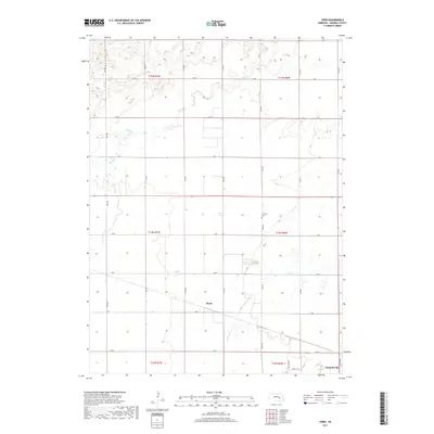
2017 Map of Hord
USGS Topo · Published 2017About this map
Silver Creek and Prairie Creek wind through this Merrick County landscape, where the agricultural grid of the Platte River Valley is clearly established. Near the southern border, the outskirts of Central City mark the primary center of activity, while the smaller settlement of Hord sits centrally among a network of numbered section roads. Local history and genealogy researchers will find Fairview Cemetery located north of the town centers, along with numerous drainage features like the Prairie Slough. The terrain is defined by its subtle elevation changes and the organized system of thoroughfares, including 13th Road and P Road, which facilitate travel across this fertile Nebraska plains region.
Find a feature on this map
29 named features on this map. Tap any name to fly to it.
Don’t see what you’re looking for? This feature index may not catch every label — zoom into the map to look around manually.
Map Details
Editions of this 2017 Hord Map
This is the sole edition of this map. No revisions or reprints were ever made.
Other maps of this area

1896 · Stromsburg
USGS Topo · 1:125,000

1899 · St. Paul
USGS Topo · 1:125,000

1955 · Belgrade SW
USGS Topo · 1:24,000

1955 · Broken Bow
USGS Topo · 1:250,000

1955 · Belgrade SE
USGS Topo · 1:24,000

1955 · Fremont
USGS Topo · 1:250,000

1956 · Broken Bow
USGS Topo · 1:250,000

1957 · Fremont
USGS Topo · 1:250,000

1958 · Fremont
USGS Topo · 1:250,000

1958 · Fullerton
USGS Topo · 1:24,000