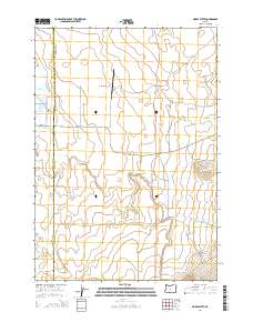
2014 Map of Horse Butte
USGS Topo · Published 2014About this map
Horse Butte rises as a prominent landmark in this high desert landscape, positioned near the boundary of Deschutes and Crook Counties. The terrain is characterized by ancient drainage patterns, most notably the channel of Dry River, which meanders across the western portion of the quadrangle. Transportation and infrastructure reflect the area's rural and ranching character, centered on the Goering Ranches Airport and a network of arterial desert roads. The layout of SW Reservoir Rd and Low Desert Rd suggests a landscape managed for water access and grazing. Small water features like Zell Pond and the headwaters of Williamson Creek provide localized points of interest amidst the expansive sagebrush and juniper country of Central Oregon.
Find a feature on this map
21 named features on this map. Tap any name to fly to it.
Don’t see what you’re looking for? This feature index may not catch every label — zoom into the map to look around manually.
Map Details
Editions of this 2014 Horse Butte Map
This is the sole edition of this map. No revisions or reprints were ever made.
Other maps of this area

1926 · Bend
USGS Topo · 1:125,000

1929 · Bend
USGS Topo · 1:125,000

1931 · Newberry Crater
USGS Topo · 1:125,000

1935 · Newberry Crater
USGS Topo · 1:125,000

1955 · Crescent
USGS Topo · 1:250,000

1955 · Bend
USGS Topo · 1:250,000

1957 · Crescent
USGS Topo · 1:250,000

1957 · Bend
USGS Topo · 1:250,000

1958 · Crescent
USGS Topo · 1:250,000

1958 · Bend
USGS Topo · 1:250,000