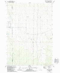
1988 Map of Horse Butte
USGS Topo · Published 1988About this map
Horse Butte rises as a prominent landmark on this high desert landscape along the border of Deschutes and Crook Counties. In the late 1980s, this area reflects a ranching-focused economy, characterized by scattered infrastructure like Goering Ranches Airstrip and numerous stock tanks designed for water management in an arid environment. The presence of Dry River and the Diversion Ditch near Willard Rd illustrates the complex history of water usage and agricultural development in this part of Oregon.
Find a feature on this map
16 named features on this map. Tap any name to fly to it.
Don’t see what you’re looking for? This feature index may not catch every label — zoom into the map to look around manually.
Map Details
Editions of this 1988 Horse Butte Map
This is the sole edition of this map. No revisions or reprints were ever made.
Other maps of this area

1926 · Bend
USGS Topo · 1:125,000

1929 · Bend
USGS Topo · 1:125,000

1931 · Newberry Crater
USGS Topo · 1:125,000

1935 · Newberry Crater
USGS Topo · 1:125,000

1955 · Crescent
USGS Topo · 1:250,000

1955 · Bend
USGS Topo · 1:250,000

1957 · Crescent
USGS Topo · 1:250,000

1957 · Bend
USGS Topo · 1:250,000

1958 · Crescent
USGS Topo · 1:250,000

1958 · Bend
USGS Topo · 1:250,000