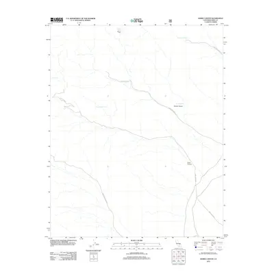
2012 Map of Horse Canyon
USGS Topo · Published 2012About this map
McIvers Cabin sits as a solitary landmark in this high-elevation landscape of eastern Kern County, defined by a network of seasonal drainages and primitive transit routes. The terrain is deeply incised by Cow Heaven Canyon, Boulder Canyon, and Horse Canyon, each hosting namesake water sources such as Cow Heaven Spring and Boulder Spring. These vital points of water were essential for early settlers and ranching operations in this arid environment. Transportation across the map is dictated by the rugged topography, with Sage Canyon Rd and Bird Spring Canyon Rd providing the primary access through the drainages. The 2012 survey illustrates the continued importance of these remote forest routes and isolated structures, like the cabin near McIvers Spring, which persist as notable waypoints for those navigating the high country.
Find a feature on this map
14 named features on this map. Tap any name to fly to it.
Don’t see what you’re looking for? This feature index may not catch every label — zoom into the map to look around manually.
Map Details
Editions of this 2012 Horse Canyon Map
This is the sole edition of this map. No revisions or reprints were ever made.
Other maps of this area

1906 · Kernville
USGS Topo · 1:125,000

1908 · Kernville
USGS Topo · 1:125,000

1915 · Searles Lake
USGS Topo · 1:250,000

1915 · Mojave
USGS Topo · 1:125,000

1943 · Inyokern
USGS Topo · 1:62,500

1943 · Cross Mountain
USGS Topo · 1:62,500

1943 · Saltdale
USGS Topo · 1:62,500

1943 · Onyx
USGS Topo · 1:62,500

1947 · Trona
USGS Topo · 1:250,000

1948 · Trona
USGS Topo · 1:250,000