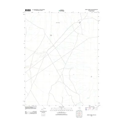
2012 Map of Horse Corral Pass
USGS Topo · Published 2012About this map
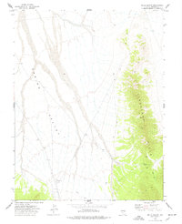
Horse Corral Pass serves as a critical topographic focal point within this 2012 survey of the Lincoln County high country. The landscape is defined by its significant vertical relief, dominated by the massif of Mount Patterson and the prominent height of Tub Peak. These peaks overlook a network of intermittent drainage systems and canyons, most notably Smiley Canyon, which cuts through the central portion of the quadrangle. Human infrastructure is limited to the corridors of Co RD 47, reflecting the sparse and transitionary nature of this region. Small, essential water sources like Garrison Seep in the southeast indicate the rare but vital hydrology necessary for life and travel in this arid environment. This map illustrates the intersection of primitive road networks and the enduring geological formations of the Great Basin.
Find a feature on this map
6 named features on this map. Tap any name to fly to it.
Don’t see what you’re looking for? This feature index may not catch every label — zoom into the map to look around manually.
Map Details
Editions of this 2012 Horse Corral Pass Map
This is the sole edition of this map. No revisions or reprints were ever made.
Other maps of this area

1956 · Lund
USGS Topo · 1:250,000

1960 · Lund
USGS Topo · 1:250,000

1973 · Schoolmarm Basin
USGS Topo · 1:24,000

1973 · Gouge Eye Well
USGS Topo · 1:24,000

1973 · Horse Corral Pass
USGS Topo · 1:24,000

1973 · Atlanta
USGS Topo · 1:24,000
1973 · Mustang Well
USGS Topo · 1:24,000
1973 · Pony Springs
USGS Topo · 1:24,000
1973 · Trail Canyon
USGS Topo · 1:24,000
1973 · Wells Summit
USGS Topo · 1:24,000