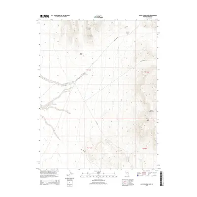
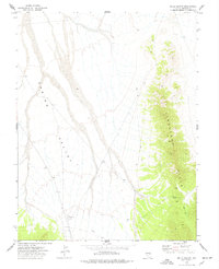
2015 Map of Horse Corral Pass
USGS Topo · Published 2015About this map
Mt Patterson towers over this section of Lincoln County, marking a high point in the Fortification Range as it meets the Wilson Creek Range. This 2015 survey reveals a landscape primarily defined by its topographic extremes and the specialized infrastructure required for resource management in the high desert. The crossing at Horse Corral Pass serves as a critical junction for remote travel, connecting the winding Horse Corral Rd with routes like Atlanta Well Rd. While much of the terrain is arid, localized water sources such as Garrison Seep and the intermittent flow of Wilson Cr dictate the movement of both wildlife and utility corridors, including the path of the Atlanta Powerline Rd cutting across the eastern slopes near Tub Peak.
Find a feature on this map
16 named features on this map. Tap any name to fly to it.
Don’t see what you’re looking for? This feature index may not catch every label — zoom into the map to look around manually.
Map Details
Editions of this 2015 Horse Corral Pass Map
This is the sole edition of this map. No revisions or reprints were ever made.
Other maps of this area

1956 · Lund
USGS Topo · 1:250,000

1960 · Lund
USGS Topo · 1:250,000

1973 · Schoolmarm Basin
USGS Topo · 1:24,000

1973 · Gouge Eye Well
USGS Topo · 1:24,000

1973 · Horse Corral Pass
USGS Topo · 1:24,000

1973 · Atlanta
USGS Topo · 1:24,000
1973 · Mustang Well
USGS Topo · 1:24,000
1973 · Pony Springs
USGS Topo · 1:24,000
1973 · Trail Canyon
USGS Topo · 1:24,000
1973 · Wells Summit
USGS Topo · 1:24,000