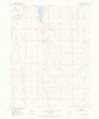
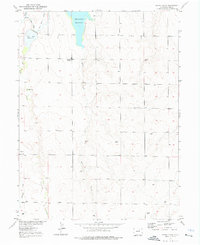
1952 Map of Horse Creek
USGS Topo · Published 1969About this map
Whittier School sits as a solitary educational landmark in this 1952 topographic study of the high plains north of Denver. The landscape is defined by the managed flow of water through the Hudson Canal and Highline Lateral, vital arteries for agriculture in this arid section of Adams County. Two significant bodies of water, Horse Creek Reservoir and Boot Lake Reservoir, dominate the northern terrain, serving as essential catchments for the intermittent drainage of Horse Creek and Box Elder Creek. Surveyed by the Geological Survey as part of the Missouri River Basin development program, the map captures a rural infrastructure of unnamed windmills, a network of unimproved roads, and a segment of irrigation Ditch labeled as Abandoned, reflecting the shifting patterns of water management and land use during the early 1950s.
Find a feature on this map
12 named features on this map. Tap any name to fly to it.
Don’t see what you’re looking for? This feature index may not catch every label — zoom into the map to look around manually.
Map Details
Editions of this 1952 Horse Creek Map
5 editions found
Other maps of this area

1890 · East Denver
USGS Topo · 1:125,000

1902 · Greeley
USGS Topo · 1:125,000

1942 · Mile High Lakes
USGS Topo · 1:31,680

1942 · Box Elder School
USGS Topo · 1:31,680

1949 · Sunnydale
USGS Topo · 1:24,000

1949 · Bennett
USGS Topo · 1:24,000

1949 · Hudson
USGS Topo · 1:24,000

1950 · Keenesburg
USGS Topo · 1:24,000

1950 · Prospect Valley
USGS Topo · 1:24,000

1951 · Keenesburg
USGS Topo · 1:24,000