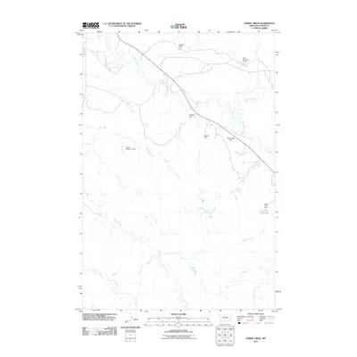
2011 Map of Horse Creek
USGS Topo · Published 2011About this map
Pumpkin Creek meanders through this section of Custer County, shaping a landscape defined by an extensive system of small-scale water management. This early 21st-century survey reveals how ranching and land use in eastern Montana rely on numerous catchment features, such as Nichols Dam, Rodgers Dam, and Muri Number 4 Dam. These engineered points are concentrated along seasonal drainages including Dry Creek and Horse Creek, illustrating the vital role of water storage in this semi-arid environment.
Find a feature on this map
17 named features on this map. Tap any name to fly to it.
Don’t see what you’re looking for? This feature index may not catch every label — zoom into the map to look around manually.
Map Details
Editions of this 2011 Horse Creek Map
This is the sole edition of this map. No revisions or reprints were ever made.
Other maps of this area

1953 · Miles City
USGS Topo · 1:250,000

1957 · Miles City
USGS Topo · 1:250,000

1958 · Miles City
USGS Topo · 1:250,000

1968 · Paddy Fay Creek
USGS Topo · 1:24,000

1969 · Horse Creek
USGS Topo · 1:24,000

1969 · Haines Springs
USGS Topo · 1:24,000

1969 · Circle L Creek
USGS Topo · 1:24,000

1969 · First Creek
USGS Topo · 1:24,000

1969 · Beebe SW
USGS Topo · 1:24,000
1969 · Beebe
USGS Topo · 1:24,000