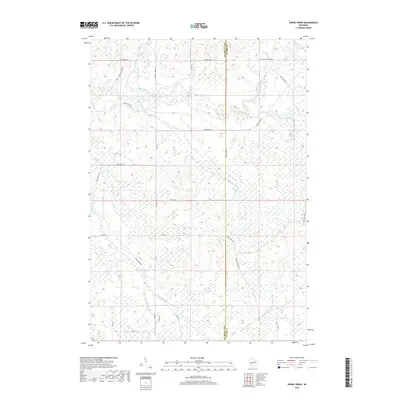
2018 Map of Horse Creek
USGS Topo · Published 2018About this map
The North Fork Eau Claire River and South Fork Eau Claire River converge in this wetland-rich landscape along the border of Eau Claire Co and Clark Co. The terrain is defined by an intricate network of waterways, including the Iron Run Flowage and smaller tributaries like Schoolhouse Cr and Surveyor Cr. Historically oriented roads such as Koehler Ford Ln suggest the importance of river crossings in the regional transit network, while names like Goat Ranch Rd and Camp Globe Rd hint at the rural agricultural and recreational character of the area. This 2018 survey provides a modern look at the hydraulic patterns and forest access routes, from Channey Rd in the north to Oak Dr in the south, highlighting the persistence of these natural and man-made corridors in rural Wisconsin.
Find a feature on this map
32 named features on this map. Tap any name to fly to it.
Don’t see what you’re looking for? This feature index may not catch every label — zoom into the map to look around manually.
Map Details
Editions of this 2018 Horse Creek Map
This is the sole edition of this map. No revisions or reprints were ever made.
Other maps of this area

1935 · Osseo
USGS Topo · 1:48,000

1940 · Osseo
USGS Topo · 1:62,500

1948 · Fairchild
USGS Topo · 1:62,500

1949 · Fairchild
USGS Topo · 1:62,500

1952 · Cadott
USGS Topo · 1:62,500

1952 · Stanley
USGS Topo · 1:62,500

1953 · Eau Claire
USGS Topo · 1:250,000

1958 · Eau Claire
USGS Topo · 1:250,000

1964 · Eau Claire
USGS Topo · 1:250,000
1968 · Osseo
USGS Topo · 1:62,500