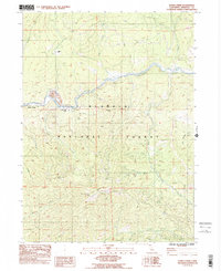
1983 Map of Horse Creek
USGS Topo · Published 1984About this map
The Klamath River carves a deep valley through this northern California landscape, serving as the primary corridor for settlement and industry in the early 1980s. Along the river's northern bank, the small community of Horse Creek and the Maplesden Ranch occupy narrow flats of land beneath Buckhorn Ridge. This area shows a clear history of resource extraction, with Tailings visible near Cherry Flat and multiple mining operations scattered across the higher elevations, including the Golden Age Mine and Columbia Mine.
Find a feature on this map
47 named features on this map. Tap any name to fly to it.
Don’t see what you’re looking for? This feature index may not catch every label — zoom into the map to look around manually.
Map Details
Editions of this 1983 Horse Creek Map
2 editions found
Other maps of this area

1886 · Shasta
USGS Topo · 1:250,000

1894 · Shasta
USGS Topo · 1:250,000

1914 · Seiad
USGS Topo · 1:125,000

1922 · Seiad
USGS Topo · 1:125,000

1932 · Yreka
USGS Topo · 1:96,000

1939 · Yreka
USGS Topo · 1:125,000

1948 · Weed
USGS Topo · 1:250,000

1950 · Weed
USGS Topo · 1:250,000

1955 · Seiad Valley
USGS Topo · 1:62,500

1955 · Condrey Mtn
USGS Topo · 1:62,500