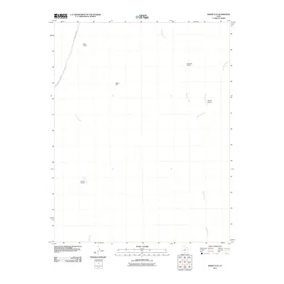
2011 Map of Horse Flat
USGS Topo · Published 2011About this map
Horse Flat and its surrounding drainage systems define this high desert landscape in southern Utah. This 2011 survey illustrates a region shaped by erosional geography, where significant corridors like Long Flat Canyon and Coyote Canyon carve through the terrain. The presence of Cottonwood Canyon Rd in the western portion of the map highlights the primary route through this backcountry, running parallel to the winding course of Cottonwood Creek. To the east, the topography is dissected by the tributaries of Wahuweap Creek, including the family-named Tommy Smith Creek and its associated Tommy Canyon. These named features, along with the distinctively titled Cads Crotch, provide a detailed record of local toponyms in a landscape primarily defined by its watercourses and canyons.
Find a feature on this map
10 named features on this map. Tap any name to fly to it.
Don’t see what you’re looking for? This feature index may not catch every label — zoom into the map to look around manually.
Map Details
Editions of this 2011 Horse Flat Map
This is the sole edition of this map. No revisions or reprints were ever made.
Other maps of this area

1886 · Escalante
USGS Topo · 1:250,000

1922 · Upper Last Chance
USGS Topo · 1:63,360

1953 · Nipple Butte
USGS Topo · 1:62,500

1954 · Paria NW
USGS Topo · 1:24,000

1954 · Paria
USGS Topo · 1:62,500

1955 · The Cockscob SW
USGS Topo · 1:24,000

1956 · Escalante
USGS Topo · 1:250,000

1960 · Escalante
USGS Topo · 1:250,000

1964 · Horse Flat
USGS Topo · 1:24,000
1964 · Calico Peak
USGS Topo · 1:24,000