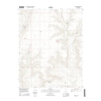
2014 Map of Horse Flat
USGS Topo · Published 2014About this map
Horse Flat and its surrounding high desert landscape dominate this Kane County survey, where complex drainage networks have carved deep into the plateau. The map is defined by the striking geology of The Cockscomb, a prominent ridge that runs parallel to Cottonwood Canyon Rd. Water dictates the topography here, from the northern Rush Beds to the meandering courses of Wahweap Cr and Coyote Cr. Named landmarks like Jack Riggs Bench and Tommy Canyon provide reference points in a region primarily used for grazing and resource management. The intricate contouring reveals the erosive power at work in Right Fork Chynoweth Canyon and Long Flat Canyon, illustrating the transition from flat mesa tops to steep-walled drainages that characterize this part of southern Utah.
Find a feature on this map
32 named features on this map. Tap any name to fly to it.
Don’t see what you’re looking for? This feature index may not catch every label — zoom into the map to look around manually.
Map Details
Editions of this 2014 Horse Flat Map
This is the sole edition of this map. No revisions or reprints were ever made.
Other maps of this area

1886 · Escalante
USGS Topo · 1:250,000

1922 · Upper Last Chance
USGS Topo · 1:63,360

1953 · Nipple Butte
USGS Topo · 1:62,500

1954 · Paria NW
USGS Topo · 1:24,000

1954 · Paria
USGS Topo · 1:62,500

1955 · The Cockscob SW
USGS Topo · 1:24,000

1956 · Escalante
USGS Topo · 1:250,000

1960 · Escalante
USGS Topo · 1:250,000

1964 · Horse Flat
USGS Topo · 1:24,000
1964 · Calico Peak
USGS Topo · 1:24,000