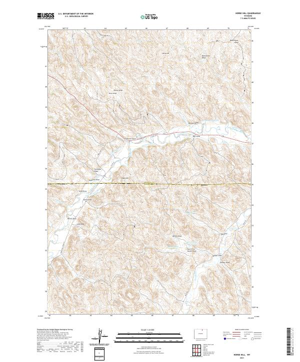
2021 Map of Horse Hill
USGS Topo · Published 2021About this map
Horse Hill and Snake Hill dominate this high-plains landscape along the border of Sheridan and Johnson Counties. This modern survey illustrates a complex network of ranching and irrigation infrastructure, where natural drainages like Piney Creek and Boxelder Cr are augmented by extensive man-made channels. Named water-management features, including the Sturdevant-Ditch, Maverick Ditch, and the Athope-Rogers-Ditch, snake through the terrain to support local livestock operations. Several reservoirs, such as Big Draw Reservoir and Belus Number 1 Reservoir, highlight the critical importance of water storage in this arid environment. The map provides a high-resolution view of the rural road system, tracing routes like Lower Piney Rd and Belus Rd as they navigate the numerous draws and gulches that define the region's topography.
Find a feature on this map
45 named features on this map. Tap any name to fly to it.
Don’t see what you’re looking for? This feature index may not catch every label — zoom into the map to look around manually.
Map Details
Editions of this 2021 Horse Hill Map
This is the sole edition of this map. No revisions or reprints were ever made.
Other maps of this area

1900 · Fort McKinney
USGS Topo · 1:125,000

1903 · Fort McKinney
USGS Topo · 1:125,000

1909 · Sheridan
USGS Topo · 1:125,000

1911 · Sheridan
USGS Topo · 1:125,000

1955 · Sheridan
USGS Topo · 1:250,000

1958 · Sheridan
USGS Topo · 1:250,000

1962 · Sheridan
USGS Topo · 1:250,000

1967 · Buffalo Run Creek
USGS Topo · 1:24,000

1967 · Lake De Smet West
USGS Topo · 1:24,000
1967 · Banner
USGS Topo · 1:24,000