
1967 Map of Buffalo Run Creek
USGS Topo · Published 1971About this map
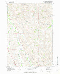
Buffalo Run Creek and its surrounding drainages define this stretch of Sheridan County landscape during the late 1960s. The terrain is a complex network of draws and creeks, including the distinctively named Hamburger Draw and John Draw, which feed into larger arteries like Prairie Dog Creek. This area shows a typical Western grazing and resource extraction pattern, with various Gravel Pits and a Mine situated among the topographic ridges. The presence of a Jeep Trail cutting across Brush Creek suggests the utilitarian access routes used for ranching and land management in this period. Other notable features like Murphy Gulch and Ninemile Prairie Creek highlight the importance of water and drainage in shaping local geography and property boundaries, as seen in the fine red dashed lines indicating fence lines that follow the natural contours of the land.
Find a feature on this map
24 named features on this map. Tap any name to fly to it.
Don’t see what you’re looking for? This feature index may not catch every label — zoom into the map to look around manually.
Map Details
Editions of this 1967 Buffalo Run Creek Map
4 editions found
Other maps of this area

1909 · Sheridan
USGS Topo · 1:125,000

1911 · Sheridan
USGS Topo · 1:125,000

1955 · Sheridan
USGS Topo · 1:250,000

1958 · Sheridan
USGS Topo · 1:250,000

1962 · Sheridan
USGS Topo · 1:250,000
1967 · Story
USGS Topo · 1:24,000
1967 · Big Horn
USGS Topo · 1:24,000
1967 · Banner
USGS Topo · 1:24,000
1968 · Sheridan
USGS Topo · 1:24,000
1968 · Wyarno
USGS Topo · 1:24,000