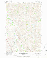
1967 Map of Buffalo Run Creek
USGS Topo · Published 1972About this map
Wildcat Creek and its many tributaries, such as the West Fork Wildcat Creek, define this Sheridan County drainage basin during the late 1960s. The landscape is characterized by a dense network of watercourses and topographical draws, including the unusually named Hamburger Draw and John Draw. Human activity is marked by resource extraction and infrastructure, notably the Gravel Pits and a Mine located near the southern boundary.
Find a feature on this map
25 named features on this map. Tap any name to fly to it.
Don’t see what you’re looking for? This feature index may not catch every label — zoom into the map to look around manually.
Map Details
Editions of this 1967 Buffalo Run Creek Map
4 editions found
Other maps of this area

1909 · Sheridan
USGS Topo · 1:125,000

1911 · Sheridan
USGS Topo · 1:125,000

1955 · Sheridan
USGS Topo · 1:250,000

1958 · Sheridan
USGS Topo · 1:250,000

1962 · Sheridan
USGS Topo · 1:250,000

1967 · Buffalo Run Creek
USGS Topo · 1:24,000
1967 · Story
USGS Topo · 1:24,000
1967 · Big Horn
USGS Topo · 1:24,000
1967 · Banner
USGS Topo · 1:24,000
1968 · Sheridan
USGS Topo · 1:24,000