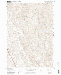
1967 Map of Buffalo Run Creek
USGS Topo · Published 1982About this map
Wildcat Creek and its many tributaries carve a intricate network through this Sheridan County landscape, defining the local drainage and land use patterns observed in the late 1960s. The terrain is characterized by numerous named draws, such as Hamburger Draw and Lewis Draw, which likely served as crucial landmarks for local ranching operations. The confluence of West Fork Wildcat Creek and the main channel, along with Buffalo Run Creek to the south, illustrates the importance of water management in this arid stretch of Wyoming.
Find a feature on this map
22 named features on this map. Tap any name to fly to it.
Don’t see what you’re looking for? This feature index may not catch every label — zoom into the map to look around manually.
Map Details
Editions of this 1967 Buffalo Run Creek Map
4 editions found
Other maps of this area

1909 · Sheridan
USGS Topo · 1:125,000

1911 · Sheridan
USGS Topo · 1:125,000

1955 · Sheridan
USGS Topo · 1:250,000

1958 · Sheridan
USGS Topo · 1:250,000

1962 · Sheridan
USGS Topo · 1:250,000

1967 · Buffalo Run Creek
USGS Topo · 1:24,000
1967 · Story
USGS Topo · 1:24,000
1967 · Big Horn
USGS Topo · 1:24,000
1967 · Banner
USGS Topo · 1:24,000
1968 · Sheridan
USGS Topo · 1:24,000