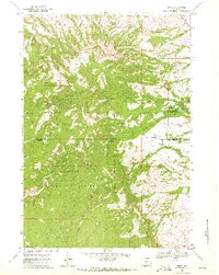
1967 Map of Story
USGS Topo · Published 1972About this map
Story sits at the foot of the Bighorn Mountains in the late 1960s, serving as a hub where mountain trails meet the foothills. The community is defined by its complex irrigation and water management system, featuring the Meade Coffee Ditch and Kruse Ditch, which divert water from the forks of South Piney Creek and North Piney Creek. This landscape reflects a deep intersection of military history and early conservation, evidenced by the Wagon Box Battle Monument and the State Fish Hatchery.
Find a feature on this map
43 named features on this map. Tap any name to fly to it.
Don’t see what you’re looking for? This feature index may not catch every label — zoom into the map to look around manually.
Map Details
Editions of this 1967 Story Map
This is the sole edition of this map. No revisions or reprints were ever made.
Other maps of this area

1895 · Dayton
USGS Topo · 1:125,000

1899 · Cloud peak
USGS Topo · 1:125,000

1900 · Fort McKinney
USGS Topo · 1:125,000

1901 · Cloud Peak
USGS Topo · 1:125,000

1901 · Dayton
USGS Topo · 1:125,000

1903 · Fort McKinney
USGS Topo · 1:125,000

1909 · Sheridan
USGS Topo · 1:125,000

1911 · Sheridan
USGS Topo · 1:125,000

1955 · Sheridan
USGS Topo · 1:250,000

1958 · Sheridan
USGS Topo · 1:250,000