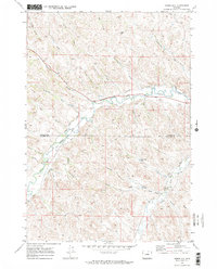
1970 Map of Horse Hill
USGS Topo · Published 1973About this map
Horse Hill rises above a complex network of ranching infrastructure and seasonal watercourses along the border of Sheridan Co and Johnson Co. This landscape is defined by its extensive water management systems, featuring early 1970s irrigation improvements like the Sturdevant Ditch and Athorpe Roger Ditch. These man-made channels draw from Piney Creek to support the surrounding dry land, feeding into storage features such as Belus No 1 Res and Belus No 2 Res.
Find a feature on this map
35 named features on this map. Tap any name to fly to it.
Don’t see what you’re looking for? This feature index may not catch every label — zoom into the map to look around manually.
Map Details
Editions of this 1970 Horse Hill Map
2 editions found
Other maps of this area

1900 · Fort McKinney
USGS Topo · 1:125,000

1903 · Fort McKinney
USGS Topo · 1:125,000

1909 · Sheridan
USGS Topo · 1:125,000

1911 · Sheridan
USGS Topo · 1:125,000

1955 · Sheridan
USGS Topo · 1:250,000

1958 · Sheridan
USGS Topo · 1:250,000

1962 · Sheridan
USGS Topo · 1:250,000

1967 · Buffalo Run Creek
USGS Topo · 1:24,000

1967 · Lake De Smet West
USGS Topo · 1:24,000
1967 · Banner
USGS Topo · 1:24,000