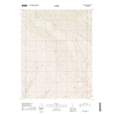
2023 Map of Horse Mountain
USGS Topo · Published 2023About this map
Horse Mtn dominates the center of this Kane County quadrangle, standing as a primary landmark above a complex network of high desert drainage systems. The landscape is defined by its deep incisions and elevated flats, including the broad Dog Flat and a series of benches that transition toward the lower canyons. This area of Southern Utah is shaped by seasonal water sources such as Tommy Smith Water and Fourmile Water, which signify vital points for survival in an otherwise arid environment.
Find a feature on this map
13 named features on this map. Tap any name to fly to it.
Don’t see what you’re looking for? This feature index may not catch every label — zoom into the map to look around manually.
Map Details
Editions of this 2023 Horse Mountain Map
This is the sole edition of this map. No revisions or reprints were ever made.
Other maps of this area

1886 · Escalante
USGS Topo · 1:250,000

1922 · Upper Last Chance
USGS Topo · 1:63,360

1956 · Escalante
USGS Topo · 1:250,000

1960 · Escalante
USGS Topo · 1:250,000

1964 · Horse Flat
USGS Topo · 1:24,000

1964 · Canaan Peak
USGS Topo · 1:24,000

1964 · Death Ridge
USGS Topo · 1:24,000

1964 · Carcass Canyon
USGS Topo · 1:24,000
1964 · Butler Valley
USGS Topo · 1:24,000

1968 · Fourmile Bench
USGS Topo · 1:24,000