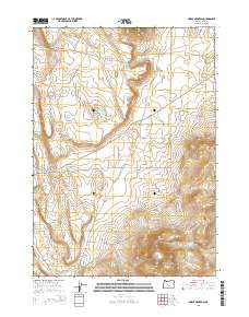
2014 Map of Horse Mountain
USGS Topo · Published 2014About this map
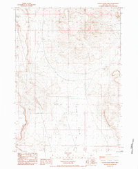
Horse Mountain and Horse Mountain Spring anchor the southeastern corner of this high desert landscape in Lake County. The terrain is defined by prominent volcanic features, including the distinct peaks of Elk Mtn and the western slopes of Fredrick Butte. This mid-2010s survey reveals a sparse but deliberate network of Bureau of Land Management roads, such as BLM 6111-0-00 and BLM 6121-0-00, which provide access to this remote rangeland. The Christmas Valley Hwy cuts a straight path through the central portion of the map, connecting the vastness of Hansen Vly with local routes like Brimwell Rd and De Sena Rd. A notable human imprint on the land is found at Brim Seeding, reflecting land management practices used to stabilize and manage vegetation in this arid environment.
Find a feature on this map
18 named features on this map. Tap any name to fly to it.
Don’t see what you’re looking for? This feature index may not catch every label — zoom into the map to look around manually.
Map Details
Editions of this 2014 Horse Mountain Map
This is the sole edition of this map. No revisions or reprints were ever made.
Other maps of this area

1955 · Crescent
USGS Topo · 1:250,000

1957 · Crescent
USGS Topo · 1:250,000

1958 · Crescent
USGS Topo · 1:250,000

1970 · Crescent
USGS Topo · 1:250,000

1981 · Sand Rock
USGS Topo · 1:24,000

1981 · Elk Butte
USGS Topo · 1:24,000
1981 · Rams Butte
USGS Topo · 1:24,000
1984 · Alkali Buttes
USGS Topo · 1:24,000
1984 · Goodrich Well
USGS Topo · 1:24,000
1984 · Poverty Basin North
USGS Topo · 1:24,000