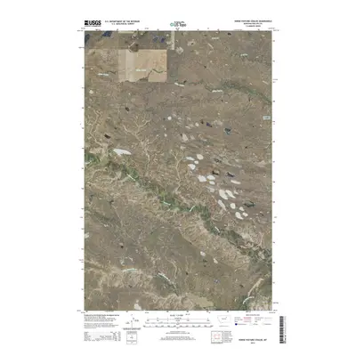
2014 Map of Horse Pasture Coulee
USGS Topo · Published 2014About this map
Horse Pasture Coulee defines the drainage patterns of this Phillips County landscape, where the seasonal movement of water has carved deep coulees across the High Plains. This 2014 survey captures a terrain dominated by ranching and grazing utility, evidenced by features like the Black Cow Reservoir. The land is organized by the Public Land Survey System, with sections of Township 27 North and Townships 31 and 32 East clearly delineated. Beyond the namesake coulee, the map traces the paths of Smith Coulee, Miller Coulee, and the intermittent flows of Beaver Cr. Human infrastructure is sparse, limited primarily to Content Rd and unnamed trails that connect these remote drainage basins. Genealogists and local historians can use this map to identify specific land parcels and natural landmarks used by generations of Montana ranchers, from Little Sevenmile Cr in the south to the northern reaches of D H S Cr.
Find a feature on this map
15 named features on this map. Tap any name to fly to it.
Don’t see what you’re looking for? This feature index may not catch every label — zoom into the map to look around manually.
Map Details
Editions of this 2014 Horse Pasture Coulee Map
This is the sole edition of this map. No revisions or reprints were ever made.
Other maps of this area

1954 · Jordan
USGS Topo · 1:250,000

1954 · Glasgow
USGS Topo · 1:250,000

1956 · Jordan
USGS Topo · 1:250,000

1957 · Glasgow
USGS Topo · 1:250,000

1958 · Glasgow
USGS Topo · 1:250,000

1958 · Jordan
USGS Topo · 1:250,000

1964 · Jordan
USGS Topo · 1:250,000

1965 · Whitcomb Lake
USGS Topo · 1:24,000

1965 · Buckley Lake
USGS Topo · 1:24,000

1965 · Sheep Coulee
USGS Topo · 1:24,000