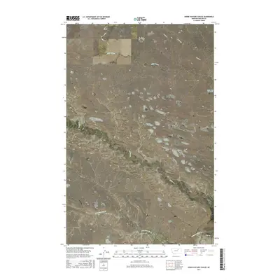
2017 Map of Horse Pasture Coulee
USGS Topo · Published 2017About this map
Horse Pasture Coulee defines the drainage pattern of this high plains landscape in Phillips County. The terrain is characterized by a series of significant coulees and creek beds that channel seasonal runoff toward larger systems. Notable waterways including Little Sevenmile Cr, Beaver Cr, and Flat Cr cut through the sections, while Black Cow Reservoir in the northeast provides a localized water source for livestock or wildlife. The sparse infrastructure is primarily represented by Content Rd, which winds across the northern and eastern portions of the map. This 2017 survey reflects the enduring cattle-grazing character of this part of Montana, where named features like Smith Coulee, Miller Coulee, and Seven Mile Coulee serve as primary landmarks for land management and navigation in an otherwise open, unpopulated expanse.
Find a feature on this map
14 named features on this map. Tap any name to fly to it.
Don’t see what you’re looking for? This feature index may not catch every label — zoom into the map to look around manually.
Map Details
Editions of this 2017 Horse Pasture Coulee Map
This is the sole edition of this map. No revisions or reprints were ever made.
Other maps of this area

1954 · Jordan
USGS Topo · 1:250,000

1954 · Glasgow
USGS Topo · 1:250,000

1956 · Jordan
USGS Topo · 1:250,000

1957 · Glasgow
USGS Topo · 1:250,000

1958 · Glasgow
USGS Topo · 1:250,000

1958 · Jordan
USGS Topo · 1:250,000

1964 · Jordan
USGS Topo · 1:250,000

1965 · Whitcomb Lake
USGS Topo · 1:24,000

1965 · Buckley Lake
USGS Topo · 1:24,000

1965 · Sheep Coulee
USGS Topo · 1:24,000