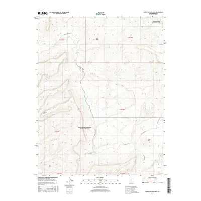
2017 Map of Horse Pasture Mesa
USGS Topo · Published 2017About this map
Horse Pasture Mesa and the surrounding high desert plateaus of Garfield County are defined by a complex network of canyons and benches that fall within some of Utah’s most protected federal lands. The landscape transitions between the southern edge of Capitol Reef National Park and the expansive Glen Canyon National Recreation Area, where the drainage of Silver Falls Cr and Moody Cr carves deep into the sandstone. This 2017 survey details a region where travel is largely dictated by the topography, primarily along the Moody Canyon Road. Historical land divisions are noted across numerous townships, including t36s r8e, while geographic landmarks such as Colt Mesa, Choprock Bench, and the Purple Hills illustrate the diverse and non-linear erosion patterns typical of this portion of the Colorado Plateau.
Find a feature on this map
18 named features on this map. Tap any name to fly to it.
Don’t see what you’re looking for? This feature index may not catch every label — zoom into the map to look around manually.
Map Details
Editions of this 2017 Horse Pasture Mesa Map
This is the sole edition of this map. No revisions or reprints were ever made.
Other maps of this area

1886 · Escalante
USGS Topo · 1:250,000

1886 · Henry Mountains
USGS Topo · 1:250,000

1892 · Henry Mountains
USGS Topo · 1:250,000

1953 · Mt Pennell
USGS Topo · 1:62,500

1953 · Circle Cliffs 1 SE
USGS Topo · 1:24,000

1953 · Circle Cliffs 4 NW
USGS Topo · 1:24,000

1953 · Circle Cliffs 1 SW
USGS Topo · 1:24,000

1953 · Mt Pennell 3 NW
USGS Topo · 1:24,000

1953 · Mt Pennell 3 SW
USGS Topo · 1:24,000

1953 · Mt Pennell 2 SW
USGS Topo · 1:24,000