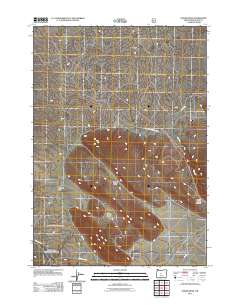
2011 Map of Horse Ridge
USGS Topo · Published 2011About this map
Horse Ridge dominates this central Oregon landscape, a prominent geological feature that shapes the local drainage and transit patterns. The map shows the winding course of the Dry River to the east, cutting through the high desert terrain near Horse Ridge Summit. This arid environment is characterized by distinct topographical depressions and basins such as Golden Basin and the open expanse of Stookey Flat. Transportation in this part of Deschutes County is defined by major arteries like the Horse Ridge Frontage Rd and local access ways such as Ford Rd and China Hat Rd. These routes provide access to the volcanic features of the Badlands in the north and the broad reaches of the Millican Valley to the southeast, illustrating how the natural topography dictates the movement of people and livestock across the sagebrush-covered plains.
Find a feature on this map
11 named features on this map. Tap any name to fly to it.
Don’t see what you’re looking for? This feature index may not catch every label — zoom into the map to look around manually.
Map Details
Editions of this 2011 Horse Ridge Map
This is the sole edition of this map. No revisions or reprints were ever made.
Other maps of this area

1926 · Bend
USGS Topo · 1:125,000

1929 · Bend
USGS Topo · 1:125,000

1931 · Newberry Crater
USGS Topo · 1:125,000

1935 · Newberry Crater
USGS Topo · 1:125,000

1955 · Crescent
USGS Topo · 1:250,000

1955 · Bend
USGS Topo · 1:250,000

1957 · Crescent
USGS Topo · 1:250,000

1957 · Bend
USGS Topo · 1:250,000

1958 · Crescent
USGS Topo · 1:250,000

1958 · Bend
USGS Topo · 1:250,000