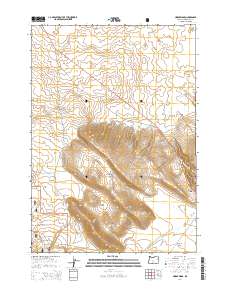
2014 Map of Horse Ridge
USGS Topo · Published 2014About this map
Horse Ridge dominates the topography of this central Oregon landscape, rising above the surrounding high desert plains southeast of Bend. The ridgeline serves as a significant natural barrier, with the Horse Ridge Summit marking its highest elevation. To the west, the volcanic influence of the region is evident with the proximity of Newberry Volcano and the protected lands of the Deschutes National Forest. The map details a network of forest and desert roads, such as China Hat Rd and Ford Rd, which navigate the transitions between the elevated ridge and lower-lying basins.
Find a feature on this map
20 named features on this map. Tap any name to fly to it.
Don’t see what you’re looking for? This feature index may not catch every label — zoom into the map to look around manually.
Map Details
Editions of this 2014 Horse Ridge Map
This is the sole edition of this map. No revisions or reprints were ever made.
Other maps of this area

1926 · Bend
USGS Topo · 1:125,000

1929 · Bend
USGS Topo · 1:125,000

1931 · Newberry Crater
USGS Topo · 1:125,000

1935 · Newberry Crater
USGS Topo · 1:125,000

1955 · Crescent
USGS Topo · 1:250,000

1955 · Bend
USGS Topo · 1:250,000

1957 · Crescent
USGS Topo · 1:250,000

1957 · Bend
USGS Topo · 1:250,000

1958 · Crescent
USGS Topo · 1:250,000

1958 · Bend
USGS Topo · 1:250,000